
post 242/365
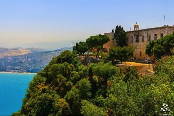
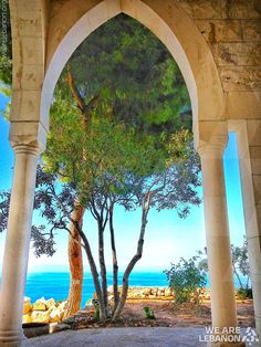
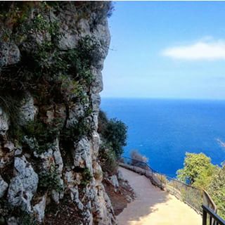
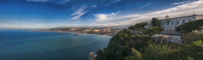
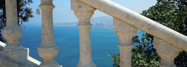
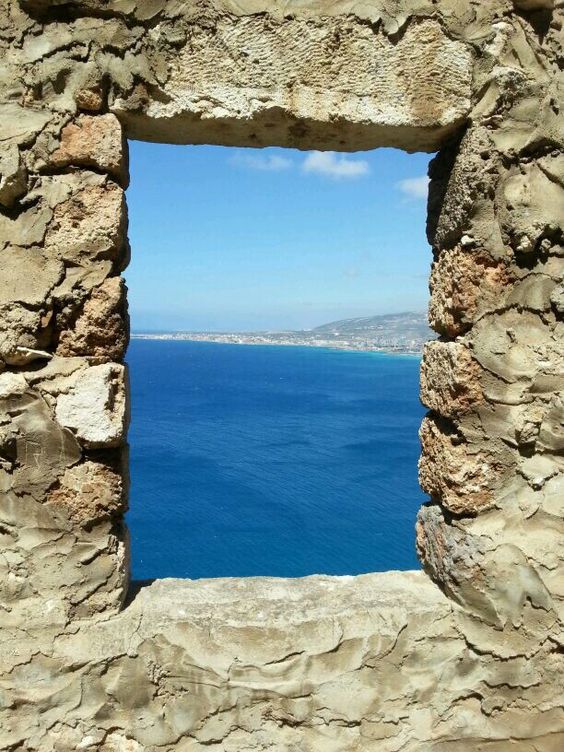
Sitting atop the mountain, overlooking the deep blue sea beneath, a light breeze strolling along the narrow path that leads to the little chapel below, stands saydet el nourieh church, “ our lady of the light.” Fenced with lush greenery and trees, standing between the sky and within hands reach of the Mediterranean, it seems like it is suspended right above the sea.
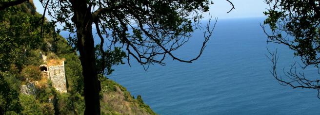
Saydet el Nourieh is located in Hamat, 287 meters atop the historic cape of Theoprosopon, a Greek name of Lithoprosopon, a cape in the north, also known today by the name of Râs ach-Chaq’a’. The cape is situated between the ancient cities of Batroun and Tripoli. The promontory creates a massive barrier that cuts through the coast of Lebanon, making it impossible for travelers to circumvent. Hamat’s name is mentioned several times in the Bible, representing the Northern edge of the kingdom of Byblos during the 3rd, 2nd and 1st millennial before Christ, and was the haunt of rebels and of brigands who imposed a ransom on passing travelers.
During Antiquity, a road that ran parallel to the sea existed, which made it possible to circumvent Cape Lithoprosopon and to connect Batroun to Tripoli. Historians report that the earthquake of 551 A.D. caused a landslide, causing the road to sink into the sea permanently, and thus isolating Tripoli from Batroun and Byblos.
The name of the cape changed throughout history. The oldest mention of the promontory appears in the writings of the Greek historian, Polybius who named it “Theou Prosopon” or “Face of God.” The name, Lithoprosopon, did not come to usage until the time of the Byzantine Emoire when the area was completely Christianized and the name of the cape was changed from “Face of God”, to Lithoprosopon or “Face of Stone.” Araaic and Syriac historians translated it to “Parsuph Kipa” and later on Arab historians translated it to “Anf Al-Hajar” and “Wajh Al-Hajar” or “Nose or Face of Stone.” At the times of the Mamluks and Ottomans, the cape’s named reverted to its Arabic name of “Wajh Al-Hajar.”
The French historian, Laurent d’Arvieux, wrote in 1660 that the Franks named it “Cape Rouge,” a corruption of the Lebanese Arabic word of “oueij,” which means “face.”
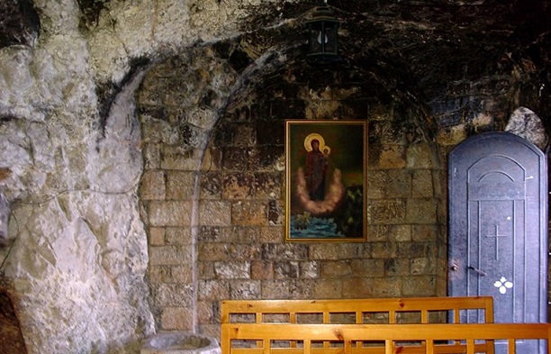
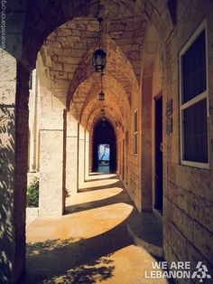
Saydet el Nourieh is a Marian Shrine. Nourieh in Arabic means nour, Light. Thus its name, Our Lady of Light. It is believed that two sailors built the original small shrine in the 4th century around 500B.C.
One winter night, on a very stormy sea, two sailors found themselves in peril, lost at sea. They began praying to the Virgin Mary to guide them through this difficult home to find their way back to land. It is said that the Virgin appeared to them as a light in the sky and guided them gently to the shore of Theoprosopon near modern day Chekka of North Lebanon. The grateful sailors carved a cave in the cliff, from where the light shone and dedicated it to the Virgin Mary, and called the shrine, Our Lady of Light.
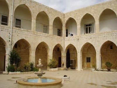
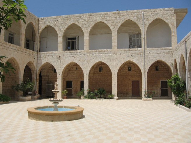
A Greek Orthodox monastery was built in the 17th century next to that cave. The miraculous icon of the Theotokos has been venerated for centuries for having glowed with light to attract wayward ships.
As I stood there captivated by the beauty of this old little church built by sailors’ bare hands and the captivating story of finding home and peace amidst the storm, I secretly whispered a little prayer in my heart for my boys;
May light shine through their darkness
To lead them where they must be
May the wind carry them someplace
When their hope fails to see
And may their heart continue beating
Even if they forget to breathe
That is the wisdom that I took with me that day from Our Lady of the Light.
*all pictures taken from #livelovelebanon and we are Lebanon

Beautiful pictures! Thanks for sharing.
LikeLike
What a breathtaking views. Just found this site. Thank you so very much KarenKaram for sharing it. I put this place in my book ‘Places I would like to visit throughout my life’. I hope I can visit it one day…
LikeLike